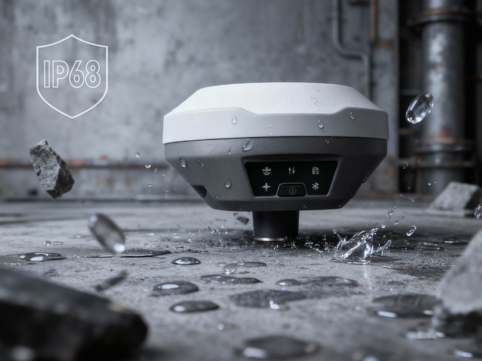
IP68
PPP 2 CM RMS
L1 / L2 / L5
NO CORS NEEDED
L-Base
IP68-rated GNSS receiver with built-in PPP processing. Dust-tight, submersible, field-ready.
Self-converging PPP base station that delivers centimetre-accurate RTK corrections to any drone — without subscribing to an expensive CORS network. Satellite-based precise point positioning, anywhere on Earth.
Ongoing costs, limited coverage, infrastructure dependency
Satellite-based, global coverage, no infrastructure

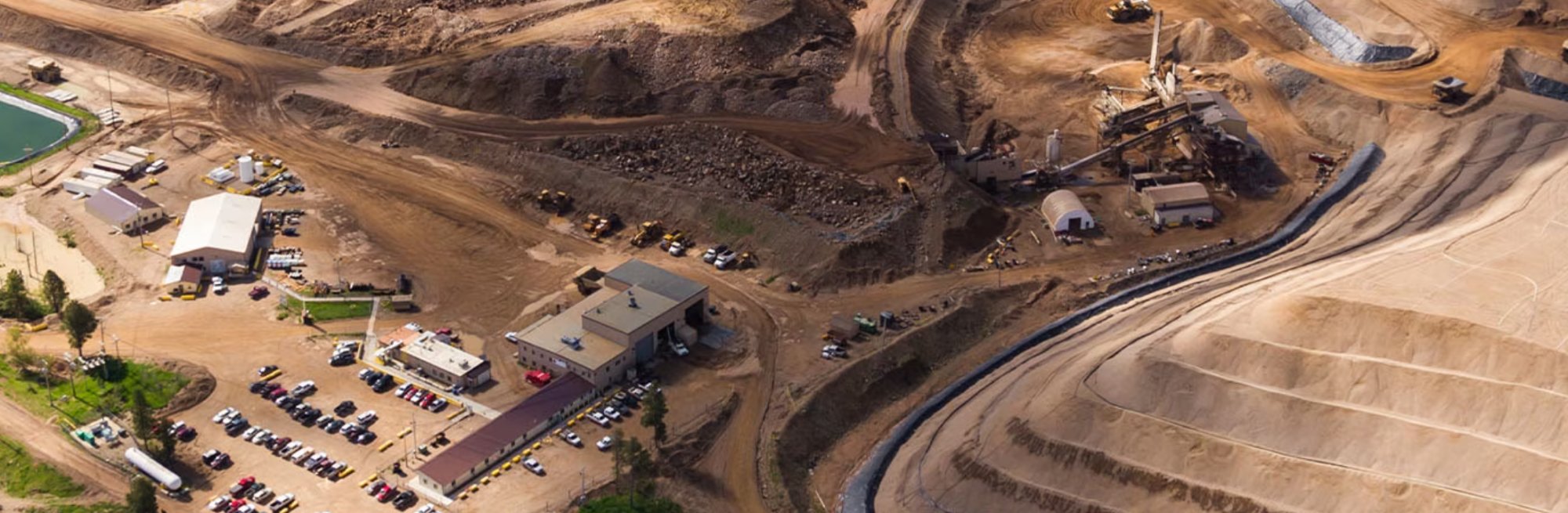
Survey-grade drone mapping without setting up a traditional base station.

Centimetre-accurate field mapping for variable-rate application and drainage planning.
Set L-Base on the ground with a clear view of the sky. No tripod needed.
Press the button. PPP auto-converges to ITRF2020 centimetre coordinates.
RTK corrections stream to your drone automatically. Centimetre accuracy, the entire flight.
Mining, construction, agriculture — L-Base delivers centimetre accuracy where CORS networks don't reach.
Multi-frequency carrier phase eliminates ionospheric delay. Precise orbit & clock corrections resolve ambiguities. Converges in ~2 minutes.
PPP coordinates locked as base station reference. Generates RTCM 3.x corrections, broadcast as NTRIP stream in real time.

Accurate volumetric surveys without CORS coverage.

Work anywhere — no cellular, no CORS, no problem.

Bridge, road & pipeline surveys with PPP precision.
| Specification | L-Base + PPP | DJI D-RTK 3 |
|---|---|---|
| Positioning | PPP — no CORS required | PPP + Network RTK (CORS-dependent) |
| CORS subscription | Not needed | Recommended for full accuracy |
| Non-DJI drones | ArduPilot, PX4, RTCM 3.x | DJI only |
| Ecosystem lock-in | None — open platform | DJI required |
| Broadcast links | Radio · 4G · Remote Controller | DJI proprietary |
| PPP accuracy | 2 cm | ±2 cm (with convergence) |
| Coverage | Global — anywhere with sky view | Limited by CORS network coverage |
| Waterproof | IP68 | IP67 |
| Setup time | ~2 minutes | ~5 minutes |
| Hardware price | From $2,399 | $1,699+ |
| Ongoing CORS cost | $0 | $500–2,000+/yr typical |
We dropped our CORS subscription on day one. L-Base just works — even in areas where we had zero network coverage.
My students use it for thesis fieldwork. Setup takes less time than explaining what CORS is.
The ROI was obvious. One device replaced our base station and our CORS subscription. Paid for itself in three months.
IP68-rated. Dust-tight. Submersible. L-Base is a compact GNSS receiver with built-in PPP processing — eliminating your dependency on CORS networks entirely.

No base station network required. Set up in 2 minutes, anywhere on Earth.
CORS subscription $1,500/yr × 3
+ base station hardware
Hardware + 1 year PPP included
Year 2-3: $999/yr
Buy the hardware. Subscribe to PPP corrections separately, or bundle and save.
| GNSS Performance | |
|---|---|
| Constellations | GPS, GLONASS, BeiDou, Galileo, QZSS, SBAS |
| Channels | 1792 |
| PPP Accuracy (H/V) | 2 cm RMS (convergence: 3 min) |
| RTK Accuracy (H/V) | 0.8 cm + 1 ppm / 1.5 cm + 1 ppm |
| Static Accuracy (H/V) | 2.5 mm + 0.5 ppm / 5 mm + 0.5 ppm |
| Update Rate | Up to 20 Hz |
| TTFF | Cold <30s · Warm <5s · Re-acquisition <1s |
| Tilt Compensation | ≤2 cm (within 60°), calibration-free |
| Communication | |
| Cellular | 4G LTE / WCDMA / GSM (FDD B1/B3/B7/B8/B20/B28, TDD B38/B40) |
| Internal Radio | 410–470 MHz UHF, 0.5W/1.0W (TrimTalk, South, Satel, Transparent) |
| Wi-Fi | 802.11 b/g/n (Hotspot mode) |
| Bluetooth | 4.1 |
| Wired | USB Type-C (OTG supported) |
| Network Protocols | NTRIP Client/Server, TCP |
| System & Data | |
| Operating System | Linux |
| Internal Storage | 8 GB |
| Data Output | RINEX, NMEA-0183 |
| Differential Format | CMR, RTCM 2.x / 3.x |
| Electrical | |
| Battery | 7000 mAh / 7.4V lithium (built-in) |
| Working Time | Up to 10 hours |
| Charging | 15W fast charge (5V 3A), 3 hrs to 90% |
| External Power | USB 5–20V |
| Physical & Environmental | |
| Dimensions | φ132 × 68 mm |
| Weight | ≈ 827 g |
| Operating Temp | -40°C to +70°C |
| Storage Temp | -55°C to +85°C |
| Ingress Protection | IP68 (dust-tight, waterproof) |
| Shock Resistance | 2 m pole drop onto concrete |
| Vibration | MIL-STD-810G |
It sits on the ground and talks to your drone while you fly. It tells your drone exactly where it is in the sky — accurate to 2 centimetres. That means your aerial survey maps and 3D models come out precise without any extra work.
You can still use GCPs for checkpoints, but L-Base dramatically reduces how many you need. Many users skip them entirely for routine jobs. That alone can save hours per mission.
Nope. Put it on the ground, press the power button, wait a couple minutes. That’s it. No apps to configure, no coordinates to type in. It figures everything out on its own.
Yes — Matrice series, Phantom 4 RTK, Mavic 3 Enterprise, and others. It also works with non-DJI drones like ArduPilot and PX4 builds. Basically any drone with an RTK input.
That’s actually where L-Base shines. It has a built-in radio link that works without any internet at all. You can fly in the middle of nowhere — mountains, farmland, desert — and still get centimetre accuracy.
All day. One charge gets you through a full day of fieldwork. You can also plug in a USB-C power bank if you need longer.
Yes — it’s compact and doesn’t need a tripod. Way more portable than the big base stations you’ve probably seen in surveying courses.
CORS subscriptions cost $500–2,000 a year, don’t work everywhere (especially rural areas), and you’re relying on someone else’s network staying online. L-Base gets the same accuracy from satellites directly, so none of those problems apply.
The bundle is $2,999 for hardware + one year of service. Compare that to a CORS subscription ($500–2,000/yr) plus a traditional base station. For thesis fieldwork or a surveying startup, it pays for itself quickly. There’s also a monthly plan at $99/mo if you only need it seasonally.
Keep working. It’s IP68 rated — fully waterproof and dust-proof. Rain, mud, puddles, no problem.

Monitor erosion and coastal change with repeatable survey-grade flights.

Plan and inspect renewable energy installations with centimetre accuracy.
Satellite-based centimetre positioning for any drone. No CORS network. No lock-in.
Order L-Base